June 29, 2005.
Today we explored the Reykjanes peninsula. Matthew stayed at Karl’s tugged up as he was not feeling the best.
A lot of the places we stopped along this trip were harbours that Pabbi had fished out of when he was on the boats. This made it similar to the trip I had taken along some of the same roads when I came through this area in 2002 with Hafþór and Pálli as like father like son, Pálli had also worked on boats that came out of the harbours of the South-West.
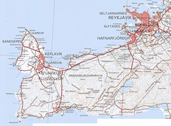
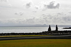
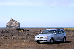
Our first stop was at Vogar, where we had a look at the boats in the Harbour, took a few photos.
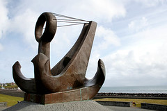
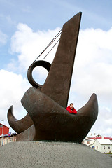
Next up was Keflavik, where we again walked round the harbour and took some photos. This was one thing I like about Iceland in general is that they are a large fan of art in public spaces.
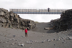
After leaving Keflavik, we jutted up to Garður for a poke round the harbour and then back down to Keflavik to head out to Hafnir. Our next stop after a poke round Hafnir was the “Bridge Between Two Continents” just south of Hafnaberg. This bridge is a bridge (duh) constructed over the Mid-Atlantic Ridge which is slowly and surely pulling Iceland apart. You can visit the gaps in various parts of Iceland and some have crevices or they may be like the one we visted which was a sand filled gulf.
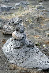
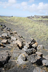
When we were here we pottered round exploring the local flora, taking photos of tourists for them and building cairns.
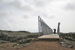
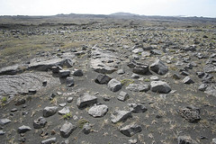
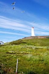
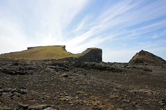
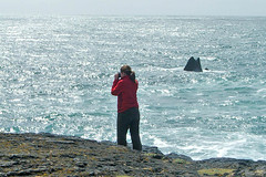
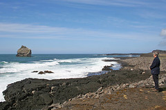
Our next stop was to head out to Reykanesviti and the cliffs of Valahnúkur. This area was amazing. There were birds everywhere, and they liked to sit on the road so as we drove up a swarm of birds would just take off before our eyes.
This area was just amazing, I mean sure it was lava rock, and bits of grass but standing on the rocks that form “the beach”, hearing the birds all around you and the sound of the waves crashing on the rocks near your feet is pretty cool.
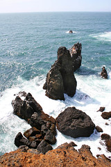
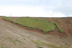
If anyone is a Sigur Rós fan or they have watched the video clip for Glósóli, you should recognise the scene in the second photo. This is the hill they go up at the end of the film clip
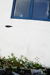
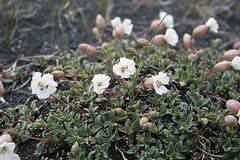
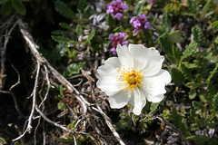
We then headed into GrindavÃk for lunch and to visit the Saltfisksetur Ã?slands (Salt Fish Museum). After that we followed the 427 round the coast and made a couple of stops to look at flowers. The first one is a Holtasóley (Mountatin Avens). The next photo is Mum up to her nose in orchids, I had decided to stay in the car, as I had taken my shoes off as my feet were starting to get sore and I didn’t fancy traipsing over rocks and pebbles with barefeet.

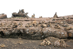
As we got closer to Kleifarvatn, we stumbled upon this cairn garden on the side of the road and we knew we had to stop and have a look round so we could tell Karl about it when we got home as he is a fan of stacking the rocks.
After stopping off at Kleifarvatn to have a look at the lake, we kept on making our way northish on the 42 and after a little while another familiar view greeted my eyes. Back in 2002 when I was going over a pretty similar road trip we were driving up this hill and there on the side of the road was this patch of grass that held a pretty good resemblance to the map of Iceland well apart from the fact it was missing the SW corner. Two and a half years later I was eager to see if it was still on that hillside and sure enough as we came over the hill there she was 🙂
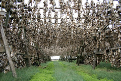
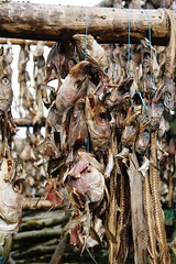
Our last stop for the day was another place I had stopped on the first trip and that was at these fish drying racks. Whilst it would have been cool to see actual fillets drying the lines of fish heads was still pretty cool 🙂
After that it was time to head back into the city to start packing for the start of our big trip in the morning which would see us start our big trip round Iceland.
Looks like you are getting some great photos!
those maps should line up better than you’re getting them to. They’re very well georeferenced.
Fun to read at the rate you’re pumping them out, it’s great to be both on holidays and in the mood for story telling
I have found some places on the maps where they don’t quite line up – mainly along the lat/long lines but some are my mistakes.
If I don’t keep to posting a day a day I will just keep putting it off.