July 1, 2005.We left HjördÃs’s house in Borgarnes with washing in the machine and clothes spread out over the heaters which she would bring with her when she left for the Moot. Today we spent time exploring parts of the Snæfellsnes Penisula.
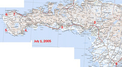
1. We headed out of Borgarnes and onto the open road 🙂
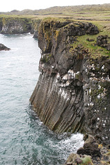
2. We pulled off the 54 to have a look at the ruler straight basalt columns at Gerðuberg, this was pretty cool, it is really long escarpment that is all these super straight basalt columns
3. I have written down in my photo log that I took a couple of photos at Böðvarsholt but I have no idea what they were of, so we shall leave it at that.
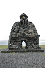
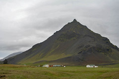
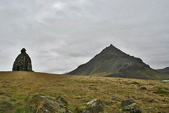
4. Arnastapi.
This was a nice little fishing town that is linked to another little fishing town (Hellnar) by a 2.5km walk along the shoreline. Mum did the walk, whilst us three drove round to meet her. I wish now that I had done the walk with her and I know that if we had visited this place at the end of our trip and not the beginning I would have but I had not yet acclimatised to the Icelandic weather when it was drizzley 🙁 Behind Arnastapi is Stapafell which is can be used to get access to Snaefellsjokull which is where “Journey to the Centre of the Earth” by Jules Verne starts.
The rock sculpture is of Bárður Snæfellsás who is the protector of the region, if Pabbi was awake whilst I was doing this, I would get him to type up the story of Bárður.
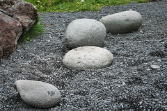
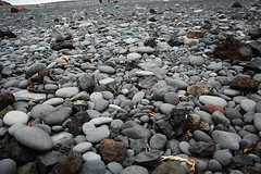
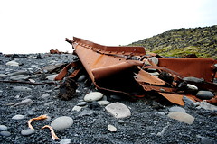
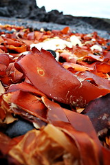
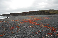
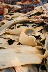
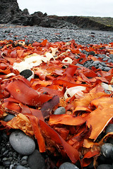
5. Djupalón and Dritvik
This beach was reasonably full of people exploring the kelp and wrecks, playing with the “lifting stones” and finding that perfect pebble. Karl also visited here about 3 weeks before us and also has photos of the area – Day trip exploring Snæfellsnes.
First up was the lifting stones, these are meant to weigh 23kg, 54kg, 100kg and 154kg but the smaller one didn’t feel like it was 23kg but less.
Then it was on to finding that perfect pebble, this was really weird because I am used to beaches that are covered with white sand, mudflats or very, very rarely black sand so visiting a beach that was all pebbles was really weird!
Then it was playing with the kelp, again I am used to kelp of the green variety so all this red and cream kelp was soo cool!
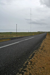
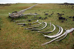
6. LORAN-C Mast and Ã?rskibrunnur
The LORAN-C Mast is the tallest structure in Iceland and some sources say the tallest in Western Europe. It was intially used as part of the LORAN navigational system but with the increased use of GPS in the 90’s it was converted into a long wave broadcasting transmitter for RUV. Ã?rskibrunnur is a well that was built by Irish Monks before the Norse settlement and uses a whale skull as the lintel. The second photo is taken just near the well of some whale bones.
7. Olafsvik.
We stopped in this largish fishing town to do some grocery shopping and the town also happened to be celebrating Faroe Islands Day so each light pole in the town had a little Lupin posy attached to it, with flags everywhere and there was a range of festival rides set up at the wharf.
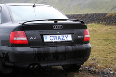
This is waterfall near the town and the other photo is of a number plate I would love to have:)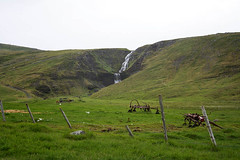
After Olafsvik we fast tailed it up to Reykjaskoli (which is not shown on the above map) to start a weekend of fun, laughter and good cheer. There are some photos from the start of the moot but I will post them with other photos from the moot.
I would have liked your company on my little walk at Arnastapi – love Mum