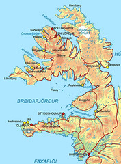
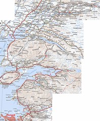
Today was a big day of driving with short stops on the side of the road to have a little poke around or fill up the petrol tanks. Whilst we only covered about 320km (which if we were doing on mainland Aus, would be 3.5hrs tops – long relativley straight roads at 100/110km/hr) for the day, because this wasn’t just Iceland roads but West Fjords roads; lots of hairpin bends, steep roads, gravel and slow speeds. It is
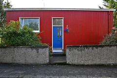
We bid farewell to Borgarnes, HjördÃs and her ultra cool house at 9am.
We hopped on the Ring Road and started heading “north” for a little while before we reached the turnoff to head to the West Fjords. We drove past Baula and enjoyed noticing the change in the country side as we changed lava periods and altidude.
Once we entered the West Fjords we basically kissed bitumen roads good bye and were on dirt for most of it – as the roads approached villages we would get bitumen but that was about it. To drive safely on these dirt roads means that you stop driving on the right and follow the wear patterns of where everyone else has driven as everything else is pretty loose gravel and that is not fun!
The maps show that in some cases the road follows the fjord round and in other times goes up over the fjord, that sounds all fine and dandy. However of course to gain the alitdute to go over the top of the fjord you have lots of hairpin bends and steep roads on gravel. It was all fun!!!
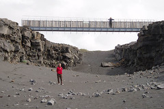
Just before the turn off out to Látrabjarg we reached Kleifaheiði which at about 520m presented Matthew and I with our first accessabile snow of the trip, so of course we jumped out of the car and ran over to have a scramble and a play. That was so cool!
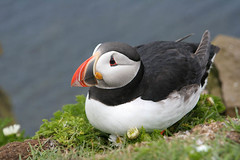
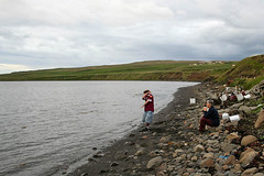
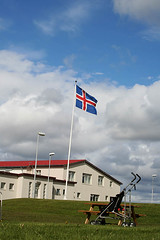
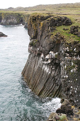
After some more pottering around we reached our destination – BreiðavÃk, which is 12km from the Látrabjarg Cliffs and where we would be staying for the night. After settling in and having dinner we piled in the car and drove out to the cliffs. These cliffs are the most westerly point of Iceland and thus also the most western point of Europe.
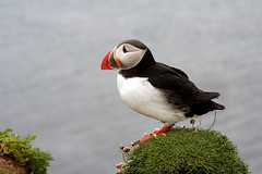
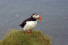
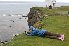
The cliffs were quite possibliy one of my favourite places that we visited, there were birds everywhere and “Hello!, Check out the Puffins!”
These were all taken around the 85mm mark and as you can see from the next two photos just how close we were getting.
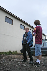
The puffins didn’t really do it for Matthew so he went back to the car to escape the weather (it was windy, cold and the clouds were kissing the grass) I was able to steal his gloves which if you look at in the above photo are Misfits skeleton gloves :).
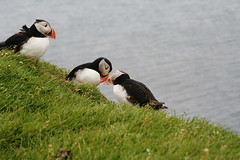
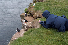
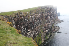
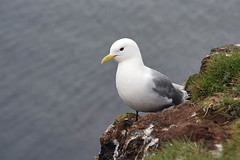
The next two photos show a section of the cliffs which are 440m’ish above the Atlantic and one of the gulls I saw out there. THe puffins are birds that hang out at the top of the cliff near the grass whilst the other birds roost on the cliff face.
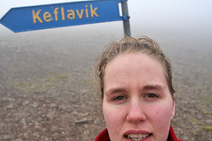
After we had taken enough photos we made the slow drive back to the hostel, for most of the drive back visibility was only a couple of meters in front of us due to the low hanging clouds. I had seen this sign for KeflavÃk on our way to the cliffs and decided on our way back I would have to get out and take a photo of a sign that points to a KeflavÃk that would not be the KeflavÃk that most people think of when they think of KeflavÃk as they would think of the town south of ReykjavÃk where the international airport and US Navy base is not a tiny hamlet on the West Fjords 🙂
July 4, 2005, revisiting the sights of Borgarfjörður.
We spent today showing Aunty Margaret some of the sights of Borgarfjörður which we had seen on Day 6 and also some new ones.
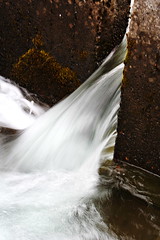
First up was to Glanni, which is on the Norðurá River near Bifröst, a waterfall that Pabbi had often visited whilst he was at school there.
One of the cool things about Glanni was the Salmon Ladder which has been built to help the Salmon travel up-stream. I would have liked to be there at the right time to see Salmon “climbing” the ladder.
Just a short drive up the road from Glanni and Bifröst is the farm where Pabbi’s mother and step-father used to live called Hraunsnef. It is now a hotel/hostel/camping ground affair and the owners were more than happy to talk to Pabbi about what they had done, what it was like when he was a kid and to let Pabbi take us on a walk round the place showing us places and telling us stories.
On the way back from Hraunsef, we stopped just before Bifröst at Grábrók and Grábrókarfell two cinder cones, where Margaret and Mum had a walk round whilst Pabbi, Matthew and I bummed round the car-park. On the way home from the ættarmót the day before Matthew and Karl had done a little run up the cinder cone so Matthew didn’t want to do it again and it was not something that really interested Pabbi or I.
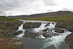
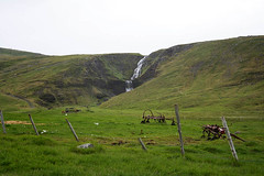
In the afternoon we headed back to Hraunfossa and Reykholt. Whilst we were at Hraunfossa we were greeted with much nicer weather than what we had 4 days earlier. Hraunfossa is a an amazing place, it is made up of a vast number of cascades coming out of the lava over a 900m stretch before falling into the river below. The water collects in the lava and flows through it into the glacial river HvÃtá below, which means that you see the white water from the glacier mixing with the blue of the rainwater. Very pretty.
After stopping in at Reykholt on the way back we made our way back to Borgarnes to spend our last night with HjördÃs and making preparations for the next leg of our trip which would lead us through the West Fjörds which is where Mum met Pabbi and where Karl was born.
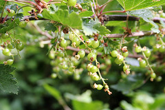
These are some currants that were growing in HjördÃs’s garden, they were a little while off been ripe though 🙁 They looked so good!
July 1-3, 2005 ættarmót (Clan Gathering) of the decendants of Jóns Einarssonar and Jóhönnu ÞórdÃsar Jónsdóttir at Reykjaskóla, Hrútafjörði.
Jón and Jóhanna were my great, grand parents and are long since dead. Tannstaðabakki is a farm just up the road from Reykjaskóla which has been in our family for at least the last three hundred years.
It is where Pabbi lived on and off for the first 14 years of his life and it is where Amma and my grandfather, a USA Army Corporal courted.
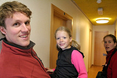
After arriving at Reykjaskóla we were shown our rooms in the “Pall Palsson Wing” which is where those descendants of my father who were not camping stayed. This meant that we were in and out of each others rooms and running amok in the hallway.
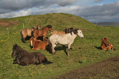
After settling in we drove up to Tannstaðabakki where a night of food, drink and cheer was waiting, set up in the barn were trestle tables and outside a BBQ was just getting fired up. It didn’t take long after we arrived to find Toti and his troop and I set off with Silja and Birta as they showed me the things they had discovered like the dog with young litter which was getting a lot of attention from all the youngsters or the horses that they liked to pat. A little while later a joyous sound rang out when Soley arrived and we gave each other a big hug.
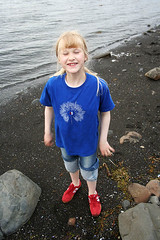
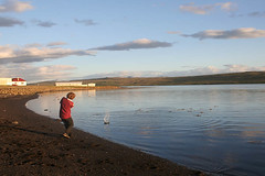
After Mum, Matthew and I had been introduced to a variety of people and short conversations of English were spoken, the adults grouped off and started talking in Icelandic to each other and Mum, Matthew, Soley and I headed down to the “beach” and explored, played and had our own merriment.
Once the sun had started to move away and the wind started to blow across the water we headed back up to the barn to spend the night humming along to Icelandic Folk Songs whilst the rest of the crew sang, smiled and had fun. Since Mum, Matthew and I aren’t exactly up with the whole Icelandic thing, most of the songs we stood round watching. There were some songs however which were ones we knew in English, so we could sing along to those ones. More often the case was that I buzzed about taking photos and Matthew and Mum stood round talking.
Day 8 – July 2, 2005
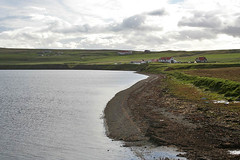
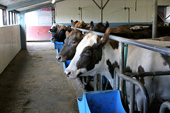
The night before Skúli had passed around word that if any one who was interested could come watch the milking of the cows in the morning, so of course Mum, Pabbi and I took up the offer and actually were the only ones and arrived before the milking had started so we went for a walk along the fjord as Pabbi pointed out the places he had played as a young fella and what had changed over the years.
After a while we walked back up the farm and chatted to Skúli and Guðrún as they went about the dairy business.
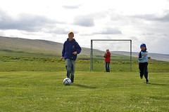
Once we got back to Reykjaskóla and had our breakfast where Mum was just as excited as she had been since our first trip to the grocery store at the chance to have Sour Milk on her cereal (much better than buttermilk). Mum and Pabbi headed off to chat to people I guess and Matthew probably was sitting somewhere listening to his MiniDisc player I headed off to act like an 8yr old with my nieces. Taking silly photos, playing soccer and attempting to play croquet, passing the camera round to whom ever wanted to take photos with it; Silja, Birta, Nonni(?) and who knows who else – it is not me, my camera and my life but us, my camera and our life 🙂
Around midday everyone headed up to Tannstaðabakki, where we were told about some of the things that they are now involved in with raising chickens, running school tours and the weather station etc. Karl had come up from Reykjavik by now so it was fun to have him around to join in on the fun and games. Birta had taken my camera again by now and was no longer just taking photos of people in “Team Red” but all the “Teams”.
After the tour was over we headed back to Reykjaskóla where Matthew and Karl played foxtail with one of the bags of clothes that we had left with him to bring up. Considering the things those two have played foxtail with over the years (old Christams trees etc) it was no surprise when they started this up. As we carried stuff in from his car, Matthew had now grabbed my camera and started taking some photos.
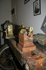
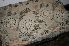
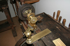
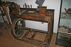
Once we were all settled we went over to the Reykir Folk Museum which is just near the school and suprise suprise Guðrún was on the door, collecting admission and handing out guides. This museum is chock full of items from the local area including quite a few items that were made by my great, great grandfather Einar Skúlason in the mid to late 1800’s.
It also includes a boat which was made in 1875 from drift wood for use a shark fishing boat in Winter and was in use until 1915, as well as a tiny boat that came in two halves for easy transport on horses, as well as a couple of reconstructed interiors of 1800’s homes.
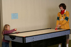
After the museum, Matthew and I headed off to the games room with a whole troop of people from the “Pall Palsson Wing” to play air-hockey, table-tennis, mini-golf and other assorted games that we came up with what we found around.
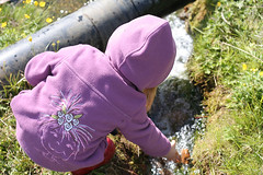
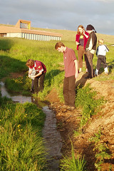
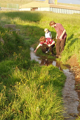
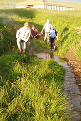
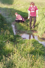
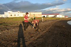
However the sun was beckoning and after looking at the egg laying hens; Soley, Birta and Jökull decided to make a dam in the little stream that came from a hot spring up the hill a bit; I joined in, offering advice and warming my arms and legs in the warm water.
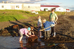
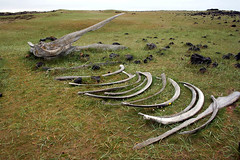
Once the dam had been built to the best of our capabilities it was time for all the kidlets and adults to be rounded up to get dressed up for the dinner. We were all on our best behaviour as we found our place card and listened to speeches that we had only a few ideas as to their content. After filling up on a wide array of foods including some very yummy brussel sprouts, I moved over to the table where Matthew was sitting and for some reason we started building little boats out of the place-cards and using wax from the tea lights to give them weight. After we had each made one or two we raced as slowly as we could down to the stream to launch our boats. Along the way we managed to draw the attention of some other kidlets and Karl and before long we had raced back up stairs to the dining room to scrounge more place-cards and tea lights to make more boats to have an all out boat race.
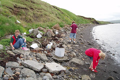
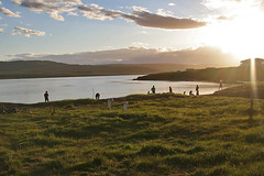
Before too long though the boats started to get shipwrecked on the banks and had to be decommissioned as race boats. Then we moved down to the shore where there were more kidlets playing in the late night sun; skimming rocks, playing round the whale bone, digging and having fun.
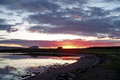
This next photo is one I really like because there is my shadow as I take the photo, Karl and Matthew in the middle finding suitable skimming rocks and Hafthor and Soley are in the background heading off home.
Once the youngest kidlets were tucked up in bed, it was time for the mice to come out and play 🙂
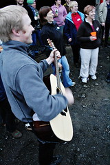
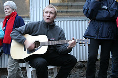
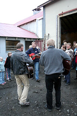
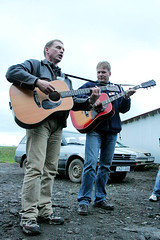
Skúli been a man of many talents had called up his band to play for a barn dance where we had fun drinking and watching people dancing before joining in on the chicken dance and the hokey pokey, watching Toti and Anna show off their dancing skills as they tore up the gym floor with their fancy footwork and seeing my parents the happiest I had seen them in ages dancing together on the gym floor. Once we were all tired out from dancing or watching we headed outside to stand round with a few drinks sharing stories and making jokes.
Day 9 – July 3, 2005
This was a lazy day, we packed up our gear and headed back to Reykjavik to pick up Aunty Margaret from the airport and Karl’s car before driving back to Borgarnes to spend the night with HjördÃs who had prepared a stellar lasagne for tea and to do more washing in preparation for the start of our trip round Iceland in the morning.
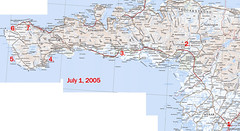
July 1, 2005.We left HjördÃs’s house in Borgarnes with washing in the machine and clothes spread out over the heaters which she would bring with her when she left for the Moot. Today we spent time exploring parts of the Snæfellsnes Penisula.
1. We headed out of Borgarnes and onto the open road 🙂
2. We pulled off the 54 to have a look at the ruler straight basalt columns at Gerðuberg, this was pretty cool, it is really long escarpment that is all these super straight basalt columns
3. I have written down in my photo log that I took a couple of photos at Böðvarsholt but I have no idea what they were of, so we shall leave it at that.
4. Arnastapi.
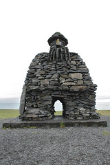
This was a nice little fishing town that is linked to another little fishing town (Hellnar) by a 2.5km walk along the shoreline. Mum did the walk, whilst us three drove round to meet her. I wish now that I had done the walk with her and I know that if we had visited this place at the end of our trip and not the beginning I would have but I had not yet acclimatised to the Icelandic weather when it was drizzley 🙁 Behind Arnastapi is Stapafell which is can be used to get access to Snaefellsjokull which is where “Journey to the Centre of the Earth” by Jules Verne starts.
The rock sculpture is of Bárður Snæfellsás who is the protector of the region, if Pabbi was awake whilst I was doing this, I would get him to type up the story of Bárður.
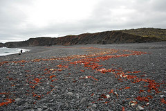
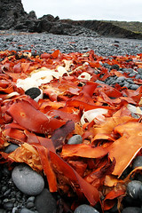
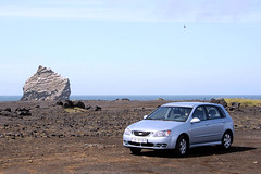
5. Djupalón and Dritvik
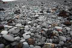
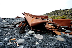
This beach was reasonably full of people exploring the kelp and wrecks, playing with the “lifting stones” and finding that perfect pebble. Karl also visited here about 3 weeks before us and also has photos of the area – Day trip exploring Snæfellsnes.
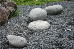
First up was the lifting stones, these are meant to weigh 23kg, 54kg, 100kg and 154kg but the smaller one didn’t feel like it was 23kg but less.
Then it was on to finding that perfect pebble, this was really weird because I am used to beaches that are covered with white sand, mudflats or very, very rarely black sand so visiting a beach that was all pebbles was really weird!
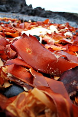
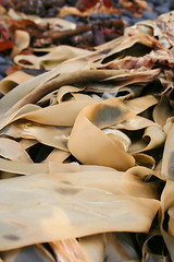
Then it was playing with the kelp, again I am used to kelp of the green variety so all this red and cream kelp was soo cool!
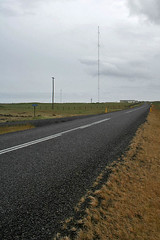
6. LORAN-C Mast and Ã?rskibrunnur
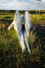
The LORAN-C Mast is the tallest structure in Iceland and some sources say the tallest in Western Europe. It was intially used as part of the LORAN navigational system but with the increased use of GPS in the 90’s it was converted into a long wave broadcasting transmitter for RUV. Ã?rskibrunnur is a well that was built by Irish Monks before the Norse settlement and uses a whale skull as the lintel. The second photo is taken just near the well of some whale bones.
7. Olafsvik.
We stopped in this largish fishing town to do some grocery shopping and the town also happened to be celebrating Faroe Islands Day so each light pole in the town had a little Lupin posy attached to it, with flags everywhere and there was a range of festival rides set up at the wharf.
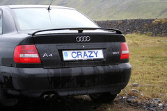
This is waterfall near the town and the other photo is of a number plate I would love to have:)
After Olafsvik we fast tailed it up to Reykjaskoli (which is not shown on the above map) to start a weekend of fun, laughter and good cheer. There are some photos from the start of the moot but I will post them with other photos from the moot.
This is a day without photos, as is half of Day 7. Somehow when I was transferring the photos from the memory cards to the storage device I messed up somehow. I lost 87 photos and Mum also lost her photos from that day.
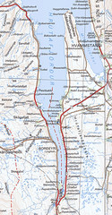
We made 8 stops today, which can be seen on the map below.
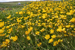
1. Pausing to admire Esja, with meadows in the foreground filled with grazing sheep and Soley (butter cups)
2. Watching some Salmon fishing and observing the mighty flow of the Laxá river. (Laxá I think might be one of the most common names for a river/creek in Iceland, as it means Salmon River; just like in Australia we have quite a few “x mile creeks”)
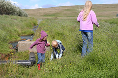
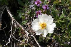
3. Wild flower hunting, playing in old sheep pens and looking at waterfalls at Fossá. This was a fantastic place to explore, Mum and I traipsed around looking at various plants, taking photos and samples. Then as we were driving along we would identify them and mark them off in the book.
4. Full steam ahead to Glymur. This was a lovely walk that took us through lots of Lupins and heaps of Anjelica. Lupines whilst pretty are to Iceland what Lantana is to Australia. My dear brother Karl went up to Glymur a fortnight before we did and like all his trip reports he as written it up perfectly and includes heaps of photos 🙂 – Karl and Tanja visit Glymur.
5. Poked around some waterfalls near Geitaberg. Mum is a big waterfall person, which means that any trip we take will involve visiting local waterfalls.
6. Reykholt. This village is the home to one of the boarding schools where Pabbi went to school and also the home of Snorri Sturluson. Whilst we were in Reykholt we had a look at Snorri’s Bath and Pabbi entertained us with tales of his school life here including students long-jumping over Snorri’s Bath which is about 3.8m in diameter.
This was one of the great things about going round the place with Pabbi and later when we had two cars I would choose to drive with Pabbi to listen to the various folktales or his memories about the places we would drive past.
7. Â Hraunfossar and Barnafoss. I will not say much about these waterfalls this time as we would revisit in a couple of days with Margaret and I have photos from that visit 🙂
We then drove over the back roads as Pabbi told us more tales about the area, such as I worked on that farm one Summer, a boy I went to school with lived on that farm etc etc.
8. Borgarnes. Such a sweet place is Borgarnes. This was our final destination for the day and we would spend the night here with Pabbi’s sister HjördÃs who greeted us with many hugs and laughs. She is so Pabbi’s sister, just hearing the tone and mannerisms she would use to say Pall was a laugh. The night could only get better because for tea we had Fish Soup. I had never had Fish Soup before and have not since and I must say I went into it a bit wary but oh my, it was utter heaven!!!
Then after lots of chatting and looking at photos it was time for bed just like it is for me now. 🙂
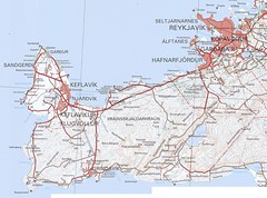
Today we explored the Reykjanes peninsula. Matthew stayed at Karl’s tugged up as he was not feeling the best.
A lot of the places we stopped along this trip were harbours that Pabbi had fished out of when he was on the boats. This made it similar to the trip I had taken along some of the same roads when I came through this area in 2002 with Hafþór and Pálli as like father like son, Pálli had also worked on boats that came out of the harbours of the South-West.
Our first stop was at Vogar, where we had a look at the boats in the Harbour, took a few photos.
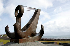
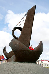
Next up was Keflavik, where we again walked round the harbour and took some photos. This was one thing I like about Iceland in general is that they are a large fan of art in public spaces.
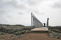
After leaving Keflavik, we jutted up to Garður for a poke round the harbour and then back down to Keflavik to head out to Hafnir. Our next stop after a poke round Hafnir was the “Bridge Between Two Continents” just south of Hafnaberg. This bridge is a bridge (duh) constructed over the Mid-Atlantic Ridge which is slowly and surely pulling Iceland apart. You can visit the gaps in various parts of Iceland and some have crevices or they may be like the one we visted which was a sand filled gulf.
When we were here we pottered round exploring the local flora, taking photos of tourists for them and building cairns.
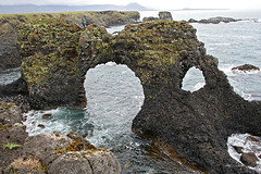
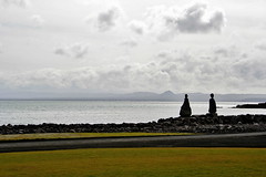
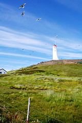
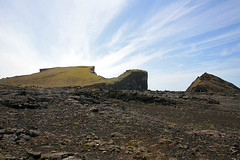
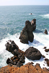
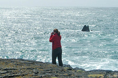
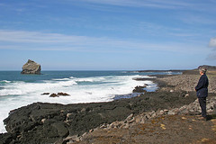
Our next stop was to head out to Reykanesviti and the cliffs of Valahnúkur. This area was amazing. There were birds everywhere, and they liked to sit on the road so as we drove up a swarm of birds would just take off before our eyes.
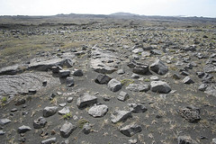
This area was just amazing, I mean sure it was lava rock, and bits of grass but standing on the rocks that form “the beach”, hearing the birds all around you and the sound of the waves crashing on the rocks near your feet is pretty cool.
If anyone is a Sigur Rós fan or they have watched the video clip for Glósóli, you should recognise the scene in the second photo. This is the hill they go up at the end of the film clip
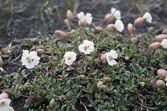
We then headed into GrindavÃk for lunch and to visit the Saltfisksetur Ã?slands (Salt Fish Museum). After that we followed the 427 round the coast and made a couple of stops to look at flowers. The first one is a Holtasóley (Mountatin Avens). The next photo is Mum up to her nose in orchids, I had decided to stay in the car, as I had taken my shoes off as my feet were starting to get sore and I didn’t fancy traipsing over rocks and pebbles with barefeet.
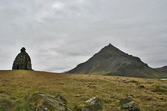
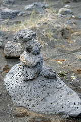
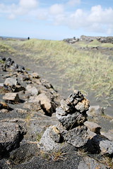
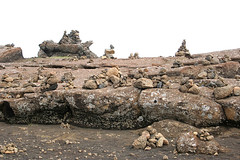
As we got closer to Kleifarvatn, we stumbled upon this cairn garden on the side of the road and we knew we had to stop and have a look round so we could tell Karl about it when we got home as he is a fan of stacking the rocks.
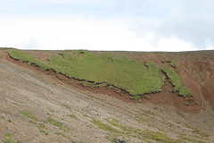
After stopping off at Kleifarvatn to have a look at the lake, we kept on making our way northish on the 42 and after a little while another familiar view greeted my eyes. Back in 2002 when I was going over a pretty similar road trip we were driving up this hill and there on the side of the road was this patch of grass that held a pretty good resemblance to the map of Iceland well apart from the fact it was missing the SW corner. Two and a half years later I was eager to see if it was still on that hillside and sure enough as we came over the hill there she was 🙂
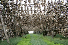
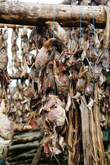
Our last stop for the day was another place I had stopped on the first trip and that was at these fish drying racks. Whilst it would have been cool to see actual fillets drying the lines of fish heads was still pretty cool 🙂
After that it was time to head back into the city to start packing for the start of our big trip in the morning which would see us start our big trip round Iceland.